


Ice-Aq Impact of temperate glaciers melting on aquifer dynamics in the case of South-East Iceland
Clémence Daigre doktorsnemi við Háskóla Íslands.
Hér segir hún okkur aðeins frá rannsókn sinni sem fjallar um vatnasvið og frárennsliskerfi undir jöklum Íslands.
The hydrodynamics of catchments headed by temperate glaciers are poorly constrained, especially the water exchanges occurring between the subglacial drainage system, the underlying aquifers, and the surface water flow. Understanding these interactions is crucial for projecting aquifers responses to the change in meltwater supply resulting from glaciers mass loss under anthropogenic climate change. The SE-outlet glaciers of Vatnajökull ice-cap, Iceland (from Breiðamerkurjökull to Fláajökull), are convenient settings to observe and enhance understanding of these dynamics.
The aim of the project is to understand the role of aquifers in the spatio-temporal circulation of water through glacierized catchments (see Figure 1), in particular underneath the glacier, and their role in the dynamics of water flows contributing to river surface discharge and water flows exported to the ocean.
The diversity of processes occuring in the system studied and its catchment scale lead us to adopt a multidisciplinary approach, combining in-situ observations, geophysical characterization and numerical modelling.
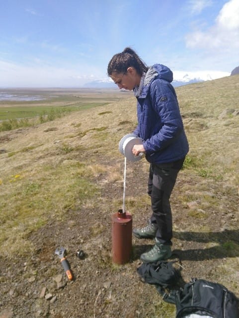
The first phase of Ice Aq project has enabled to propose a hydrogeological conceptual model, identifying 3 major aquifers (patches of subglacial tills, glacio-fluvial deposits, and basalt). The study site has been equipped with 18 observation boreholes, 6 in glaciofluvial deposits and 12 in basalts. We constrained the hydraulic parameters and geometry of aquifers; and showed that there is drainance (upward water flow) from the basalt aquifer to the glacio-fluvial deposits aquifer in the forefield.
To monitor the flow rates of surface river, we performed passive seismic acquisition by river banks for 6 main exutory rivers and constrained the calibration technique using the control site of Kolgrima, equipped with a gauging station. This will help understand the response of river flow to variations in glacier melting, rainfall and baseflow from the aquifers.
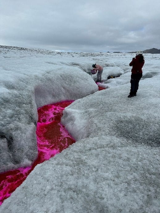
To characterize the subglacial drainage system, 8 dye-tracing experiments have been done onto Breiðamerkurjökull and Skàlafellsjökull in June and September 2023, along with passive seismic acquisition onto the glacier for 6 days in June 2023. Under Skàlafellsjökull, the subglacial system is channelized at least from early June to late September. The tracings show that 50 to 60% of glacier surface meltwater infiltrates under Skàlafellsjökull, a kilometer from the terminus. Two time-lapse cameras have been installed to monitor exutory rivers discharge year-round and The comparaison between the discharge at the exutory of Skàlafellsjökull (time-lapse camera) and Flàajökull (seismometer); and the total surface and basalt melt on the corresponding subglacial catchments will give global subglacial infiltration (or exfiltration) rates in summer and winter.
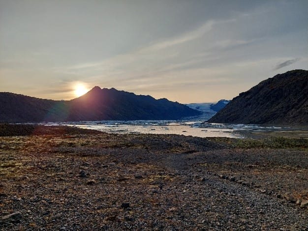
Breiðarmerkurjökull í sólsetri.
Að lokum.
Lastly, numerical modeling using Elmer\Ice model will help quantify the global water exfiltration in the sea and in the surface river network; and to spatialize the subglacial water exchanges. The biggest risk for the area studied is indeed floods in the sandur due to the rising of the groundwater level in the basalt and glacio-fluvial deposits aquifers. The results of this project (especially numerical modeling) will help project this groundwater rise.
A participatory approach has been implemented, especially with Glacier Adventure company in Hali (Haukur Einarsson), with guides measuring weekly the groundwater level in Hali. Outreach presentations have been done in Nyheimar (Höfn) in October 2023, in Hali in June 2024 and will continue to be done as we get more results and go back to the study site.
If you are interested in this subject and you want to know more: https://egusphere.copernicus.org/preprints/2023/egusphere-2022-1442/